Le 7 février 2022
Landsat 9 a effectué son propre passage la semaine dernière, à temps pour le grand match.
Des passages seront effectués aujourd’hui à Los Angeles à l’occasion du Super Bowl, l’un des événements sportifs les plus regardés chaque année aux États-Unis. En début de semaine, l’un des satellites les plus récents de la communauté scientifique a également survolé LA, poursuivant ainsi 50 ans d’observation de la ville – et de la planète – depuis le ciel.
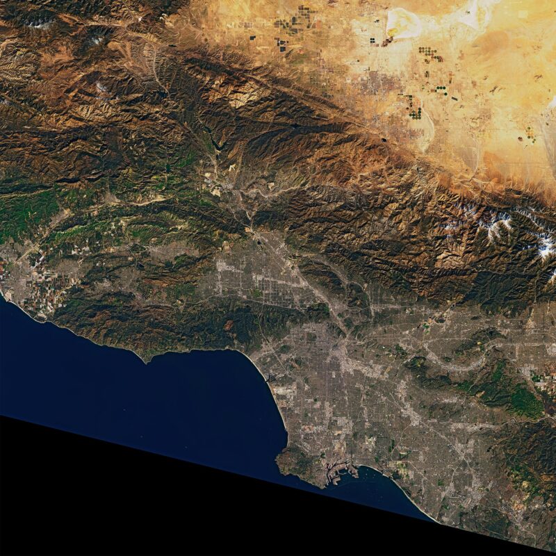
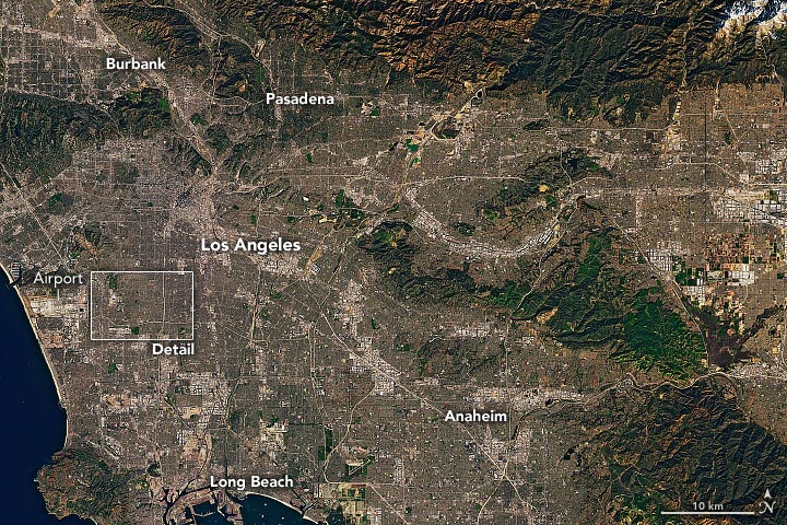
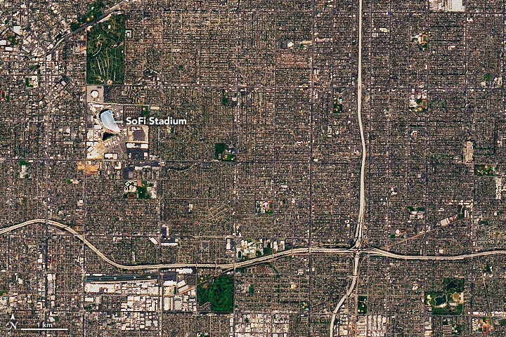
Le 7 février 2022, l’imageur terrestre opérationnel 2 (OLI-2) de Landsat 9 a pris ces vues en couleurs naturelles de la région de Los Angeles. Le Super Bowl, championnat de football américain, se jouera au SoFi Stadium à Inglewood, en Californie. Ce sera la huitième fois que la région de Los Angeles accueillera le Super Bowl, mais la première depuis 1993.
;” data-gt-translate-attributes=”[{” attribute=””>NASA launched Landsat 9 in September 2021 from the Vandenberg Space Force Base, about 150 miles (240 kilometers) up the road from Los Angeles. The satellite took its “first light” images on October 31, and mission operators have since been testing the satellite’s systems and subsystems and calibrating its instruments. In late January 2022, NASA transferred operation of Landsat 9 to the U.S. Geological Survey (USGS).
February 7, 2022
On February 10, USGS announced that Landsat 9 data is now available for free download from EarthExplorer, Machine to Machine (M2M), and LandsatLook. Since October 31, 2021, Landsat 9 has collected more than 57,000 images of Earth. The images will be processed, archived, and distributed from the USGS Earth Resources Observation and Science Center.
Landsat 9 carries two main instruments: OLI-2, which detects visible, near-infrared, and shortwave-infrared light in nine wavelengths, and the Thermal Infrared Sensor 2 (TIRS-2), which detects thermal radiation in two wavelengths used to measure Earth’s surface temperatures. The new satellite and instruments are quite similar in design to Landsat 8, which was launched in 2013 and remains in orbit. Together the satellites will collect approximately 1,500 images of Earth’s surface every day, observing the entire planet every eight days.
Landsat 9 features several improvements, including higher radiometric resolution, allowing OLI-2 to detect more subtle differences in surface features, especially over darker areas like water or dense forests. With 14-bit radiometric resolution, Landsat 9 can differentiate more than 16,000 shades of a given wavelength; Landsat 8 provides 12-bit data and 4,096 shades. Landsat 7, the satellite being replaced, detects only 256 shades with its 8-bit resolution.
February 7, 2022
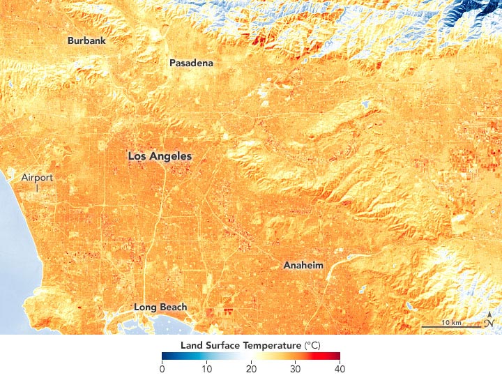
The third image was acquired on February 7 with the TIRS-2 instrument on Landsat 9. It shows land surface temperatures just before a winter heat wave hit Southern California. Temperatures have been 15 to 20 degrees Fahrenheit (8° to 11° Celsius) above normal this week in many parts of California, and several towns and cities (including Burbank) set new daily temperature records in February. The National Weather Service declared a heat advisory for February 9–13. Some forecasters are suggesting this Super Bowl could see some of the warmest game-time temperatures on record.
NASA Earth Observatory images by Joshua Stevens, using Landsat data from the U.S. Geological Survey.