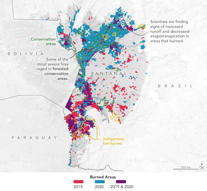
2019 – 2020
La chaleur et la sécheresse ont exacerbé la saison des feux en 2020, mais le pâturage du bétail et d’autres activités humaines ont également préparé la région à brûler.
L’une des plus grandes zones humides d’eau douce du monde-le Pantanal-s’étend sur une plaine en forme de cuvette où se rencontrent la Bolivie, le Brésil et le Paraguay. Pendant la saison des pluies, la plupart du temps, les eaux de crue de plusieurs rivières sud-américaines gonflées s’écoulent dans ce vaste delta intérieur, réapprovisionnant les marais et les marécages. La région abrite des milliers d’espèces végétales et animales, dont des jaguars rares et menacés, des aras hyacinthes et des loutres de rivière géantes.
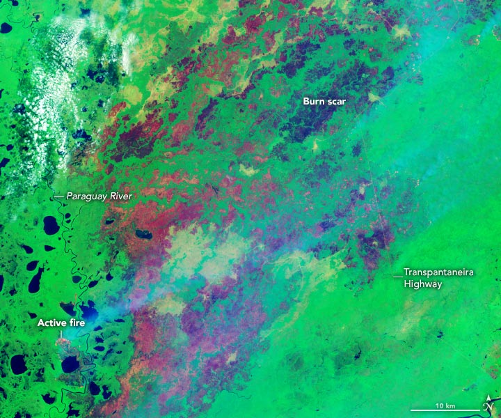
Mais en 2019 et 2020, alors que la région est en proie à une crise économique et financière, le gouvernement a décidé de mettre en place un plan d’action. grave sécheresseces eaux de crue rafraîchissantes ne sont jamais arrivées. En juin et juillet, ce sont les incendies qui sont apparus. Au début, ils brûlaient sporadiquement, mais en août et septembre, ils se sont déchaînés avec une telle férocité qu’ils ont noirci de vastes étendues du Pantanal. Les incendies ont recouvert les villes proches et lointaines d’un nuage de fumée. Les incendies ont été sévères en 2019, carbonisant environ 16 000 kilomètres carrés (6 200 miles carrés). Mais en 2020, l’ampleur a été catastrophique, brûlant un tiers de l’ensemble du biome. Une superficie remarquable de 39 000 kilomètres carrés (15 000 miles carrés) a brûlé en 2020, soit une surface équivalente à celle de la Suisse.
Au lendemain des incendies de 2020, l’explication simple de ces vastes incendies était que le temps exceptionnellement sec et chaud les avait alimentés. Mais une nouvelle étude menée par ;” data-gt-translate-attributes=”[{” attribute=””>NASA scientists suggests that human activity played a critical role in exacerbating them. The study was published in Scientific Reports in January 2022.
September 6, 2020
“It is certainly true that extreme heat and drought in 2020 worsened the fires, but that’s not the whole story,” said Sujay Kumar, a hydrologist at NASA’s Goddard Space Flight Center. “It is also clear, based on a range of data, that these fires would not have happened in the absence of human activity. We even saw a very specific pattern of fire activity that suggests people allowed or even encouraged fires to burn in forested areas.”
Together with colleagues from the Federal University of Rio de Janeiro, Cardiff University, and NASA’s Marshall Space Flight Center, Kumar analyzed land cover and burned area data from NASA’s Moderate Resolution Imaging Spectroradiometer (MODIS), precipitation data from the Global Precipitation Measurement (GPM) mission, and soil moisture data from the Soil Moisture Active Passive (SMAP) satellite. The team also considered the density of cattle operations.
“With over 52 percent of natural areas burned compared to only 6 percent of regions with high-cattle density, it is clear that natural, not human-dominated landscapes were most affected by the 2020 fires,” said study co-author Niels Andela, a remote sensing scientist at Cardiff University. “The sensitivity of natural landscapes to fire-driven degradation has been a concern across the southern Amazon for years. With this research, we provide the first large-scale evidence that the same mechanisms may be applicable across the tropics, including in the Pantanal.”
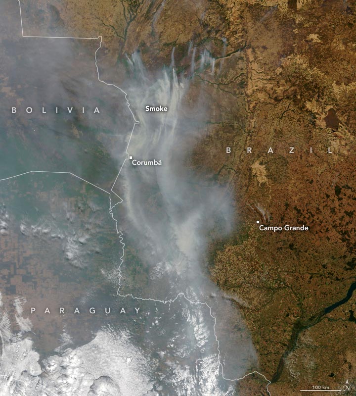
August 27, 2020
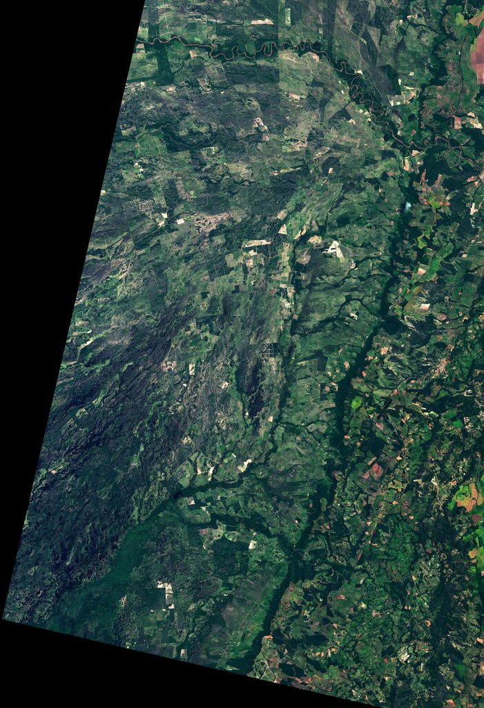
February 20, 2000
February 20, 2000
The researchers also looked for signs that the fires may have changed the ecosystem in lasting ways. They examined the region’s hydrology—how water flows across the landscape—using a data assimilation model called the Land Information System. The LIS combines satellite- and ground-based observations with modeling techniques that characterize land surface conditions.
“Several months after the fire, we saw clear evidence of decreased evapotranspiration and more surface runoff, trends that can trigger or accelerate desertification,” said NASA hydrologist Augusto Getirana, one of the study’s co-authors. Scorched soils with less vegetation can mean less rainfall being soaked up by plants, more water and sediment running off the land into streams, and less moisture exchange with the air above. “All of this adds up to increased land degradation.”
Changes like these could cause new challenges for the region’s wildlife, which have already been hit hard by the burning and may struggle under new environmental conditions. One group of biologists that surveyed the Pantanal soon after the fires estimated that at least 17 million vertebrates were likely killed, including millions of snakes, rodents, and birds.
While conservation areas and indigenous territories have been set up to limit development in parts of the Pantanal, the human fingerprint on the landscape is sizable and growing. Another recent study estimated that the amount of the Pantanal devoted to agriculture—typically cattle pasture—has increased by 3.5 percent per year since the mid-1980s. Some 3.8 million cattle are now spread among 3,000 farms, according to one estimate. Ranchers in the Pantanal regularly use fire to maintain pastures and sometimes to clear areas to establish new pastures.
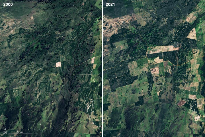
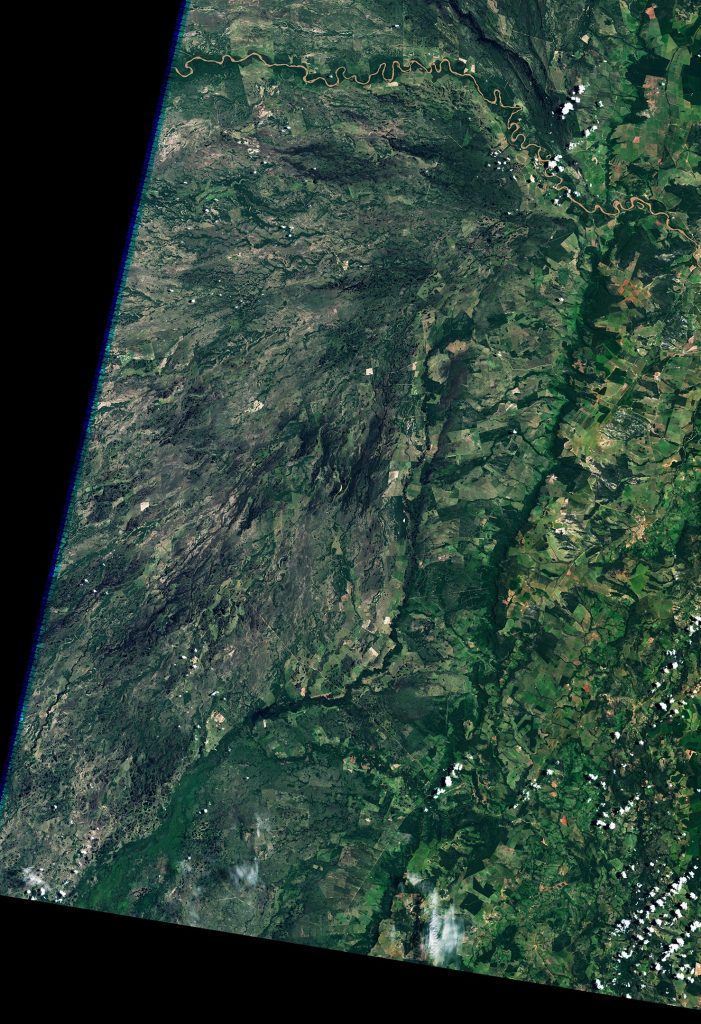
February 20, 2000 – February 21, 2021
The expansion of pasture is evident in the pair of natural-color Landsat images above, which show part of Mato Grosso do Sul near Morrinho. While the area had minimal development and was mostly natural in 2000 (left image), much of it had been converted into pasture by 2021 (right image). Clearings for pastures appear as light green and brown rectangles. Surface water is dark blue.
“As in other parts of the Amazon Basin, we are essentially seeing an arc of deforestation and land cover change spread along the Upper Paraguay River,” said Renata Libonati of Federal University of Rio de Janeiro. “There is little that is natural about these fires. Some were probably lit intentionally to maintain pastures on or near ranches. Others were accidental but associated with human activities—things like campfires, burning trash, electrical wires, motor vehicles, hunting, and beekeeping.” Lightning sometimes ignites fires in the Pantanal, but these fires tend to be small, causing just 5 percent of the total burned area on average. Also, lightning-triggered fires generally burn in the austral summer (December-February) not the winter (June-August).
Further encroachment, combined with climate change and fires, is worrisome to Libonati. “We know that compound drought-heatwaves like we saw in 2020 are likely to become more common in the future due to climate change,” said Libonati. “It’s become obvious that we’re going to need long-term management strategies to protect the Pantanal from future fire outbreaks like this.”
NASA Earth Observatory images by Lauren Dauphin, using data from Kumar, Sujay, et al. (2022) and Landsat data from the U.S. Geological Survey