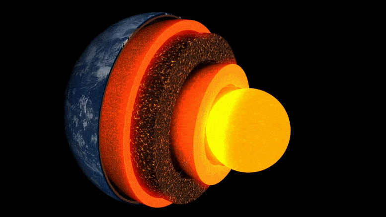
Animation des couches de la Terre.
Une nouvelle recherche menée par l’Université de Cambridge est la première à obtenir une “image” détaillée d’une poche inhabituelle de roche à la couche limite avec le noyau de la Terre, à quelque trois mille kilomètres sous la surface.
La mystérieuse zone rocheuse, qui se trouve presque directement sous les îles Hawaï, est l’une des nombreuses zones à très faible vitesse, appelées ainsi parce que les ondes sismiques ralentissent à vue d’œil lorsqu’elles les traversent.
La recherche, publiée le 19 mai 2022 dans le journal Nature Communicationsest la première à révéler en détail la variabilité interne complexe de l’une de ces poches, éclairant ainsi le paysage de l’intérieur profond de la Terre et les processus qui y opèrent.
“De toutes les caractéristiques de l’intérieur profond de la Terre, celles-ci sont les plus fascinantes et les plus complexes.” – Zhi Li
“De toutes les caractéristiques intérieures profondes de la Terre, celles-ci sont les plus fascinantes et les plus complexes. Nous avons maintenant la première preuve solide pour montrer leur structure interne – c’est un véritable jalon dans la sismologie de la terre profonde”, a déclaré l’auteur principal Zhi Li, étudiant en doctorat au département des sciences de la terre de Cambridge.
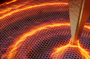
L’intérieur de la Terre se compose de plusieurs couches, comme un oignon : au centre se trouve le noyau de fer et de nickel, entouré d’une couche épaisse appelée le manteau, et par-dessus, une fine enveloppe extérieure, la croûte sur laquelle nous vivons. Bien que le manteau soit une roche solide, il est suffisamment chaud pour s’écouler extrêmement lentement. Ces courants de convection internes transmettent la chaleur à la surface, entraînant le mouvement des plaques tectoniques et alimentant les éruptions volcaniques.
Les scientifiques utilisent les ondes sismiques des tremblements de terre pour “voir” sous la surface de la Terre – les échos et les ombres de ces ondes révèlent des images de type radar de la topographie intérieure profonde. Mais, jusqu’à récemment, les “images” des structures situées à la frontière entre le noyau et le manteau, une zone d’intérêt clé pour l’étude du flux thermique interne de notre planète, étaient granuleuses et difficiles à interpréter.

Événements et trajets des rayons Sdiff utilisés dans cette étude. A) Coupe transversale tranchant le centre de la zone hawaïenne à très basse vitesse, montrant les trajets des rayons des ondes Sdiff à 96°, 100°, 110° et 120° pour le modèle terrestre 1D PREM. Les lignes en pointillés de haut en bas marquent la discontinuité de 410 km, 660 km, et 2791 km (100 km au-dessus de la limite noyau-manteau). B) Événements et trajets des rayons Sdiff sur le modèle de tomographie de fond SEMUCB_WM1 à 2791 km de profondeur. Ballons de plage d’événements tracés en différentes couleurs, notamment 20100320 (jaune), 20111214 (vert), 20120417 (rouge), 20180910 (violet), 20180518 (brun), 20181030 (rose), 20161122 (gris), stations (triangles), et trajets des rayons des ondes Sdiff à la profondeur de percée de 2791 km dans le manteau inférieur utilisé dans cette étude. L’événement utilisé dans l’analyse à courte période est surligné en jaune. L’emplacement proposé pour l’ULVZ est indiqué dans le cercle noir. La ligne pointillée montre la section transversale tracée en A. Crédit : Nature Communications, DOI : 10.1038/s41467-022-30502-5
Les chercheurs ont utilisé les dernières méthodes de modélisation numérique pour révéler des structures à l’échelle du kilomètre à la frontière entre le noyau et le manteau. Selon le coauteur, le Dr Kuangdai Leng, qui a mis au point ces méthodes alors qu’il travaillait à l’University of Oxford, “We are really pushing the limits of modern high-performance computing for elastodynamic simulations, taking advantage of wave symmetries unnoticed or unused before.” Leng, who is currently based at the Science and Technology Facilities Council, says that this means they can improve the resolution of the images by an order of magnitude compared to previous work.
The researchers observed a 40% reduction in the speed of seismic waves traveling at the base of the ultra-low velocity zone beneath Hawaii. This supports existing proposals that the zone contains much more iron than the surrounding rocks – meaning it is denser and more sluggish. “It’s possible that this iron-rich material is a remnant of ancient rocks from Earth’s early history or even that iron might be leaking from the core by an unknown means,” said project lead Dr Sanne Cottaar from Cambridge Earth Sciences.

Conceptual cartoons of the Hawaiian ultra-low velocity zone (ULVZ) structure. A) ULVZ on the core–mantle boundary at the base of the Hawaiian plume (height is not to scale). B) a zoom in of the modeled ULVZ structure, showing interpreted trapped postcursor waves (note that the waves analyzed have horizontal displacement). Credit: Nature Communications, DOI: 10.1038/s41467-022-30502-5
The research could also help scientists understand what sits beneath and gives rise to volcanic chains like the Hawaiian Islands. Scientists have started to notice a correlation between the location of the descriptively-named hotspot volcanoes, which include Hawaii and Iceland, and the ultra-low velocity zones at the base of the mantle. The origin of hotspot volcanoes has been debated, but the most popular theory suggests that plume-like structures bring hot mantle material all the way from the core-mantle boundary to the surface.
With images of the ultra-low velocity zone beneath Hawaii now in hand, the team can also gather rare physical evidence from what is likely the root of the plume feeding Hawaii. Their observation of dense, iron-rich rock beneath Hawaii would support surface observations. “Basalts erupting from Hawaii have anomalous isotope signatures which could either point to either an early-Earth origin or core leaking, it means some of this dense material piled up at the base must be dragged to the surface,” said Cottaar.
More of the core-mantle boundary now needs to be imaged to understand if all surface hotspots have a pocket of dense material at the base. Where and how the core-mantle boundary can be targeted does depend on where earthquakes occur, and where seismometers are installed to record the waves.
The team’s observations add to a growing body of evidence that Earth’s deep interior is just as variable as its surface. “These low-velocity zones are one of the most intricate features we see at extreme depths – if we expand our search, we are likely to see ever-increasing levels of complexity, both structural and chemical, at the core-mantle boundary,” said Li.
They now plan to apply their techniques to enhance the resolution of imaging of other pockets at the core-mantle boundary, as well as mapping new zones. Eventually, they hope to map the geological landscape across the core-mantle boundary and understand its relationship with the dynamics and evolutionary history of our planet.
Reference: “Kilometer-scale structure on the core–mantle boundary near Hawaii” by Zhi Li, Kuangdai Leng, Jennifer Jenkins and Sanne Cottaar, 19 May 2022, Nature Communications.
DOI: 10.1038/s41467-022-30502-5